| EXAMPLES OF THE RADIUS M IMAGES | |||||
| (reduced initial images 1350 × 1035) | |||||
| M02 | M03 | M08 | M12 | M13 | M14 |
|---|---|---|---|---|---|

| 
| 
| 
| 
| 
|
| M18 | M27 | M31 | M34 | M37 | M40 |

| 
| 
| 
| 
| 
|
In 1996, I conducted together with Prof. Robert Haralick (University of Washington, USA) first successful experiments in voxel-based multiple-view terrain reconstruction. In our paper, presented at the CAIP'97 conference in Kiel, Germany:
G. L. Gimel'farb and R. M. Haralick, "Terrain Reconstruction from Multiple Views", Proc. of the 7th Int. Conf. on Computer Analysis of Images and Patterns (CAIP'97), September 1997, Kiel, Germany (G.Sommer, K.Daniilidis, J.Pauli, eds.). Lecture Notes in Computer Science 1296, Springer-Verlag : Berlin, 1997, pp. 694-701.
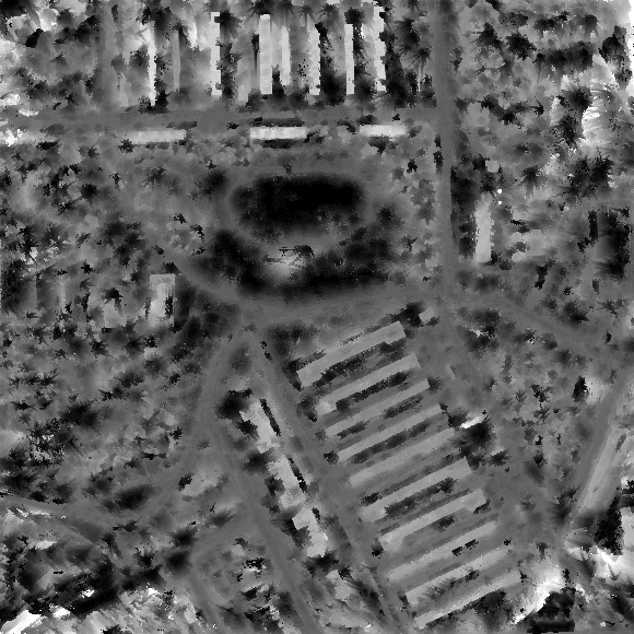
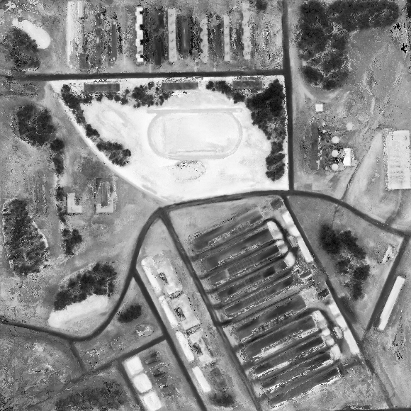
we described results of reconstruction of the RADIUS model-board scene "M" from 40 pre-calibrated images collected by different cameras having different positions and orientations, under various illimination, and in different time.
| EXAMPLES OF THE RADIUS M IMAGES | |||||
| (reduced initial images 1350 × 1035) | |||||
| M02 | M03 | M08 | M12 | M13 | M14 |
|---|---|---|---|---|---|
|
|
|
|
|
|
|
| M18 | M27 | M31 | M34 | M37 | M40 |
|
|
|
|
|
|
|
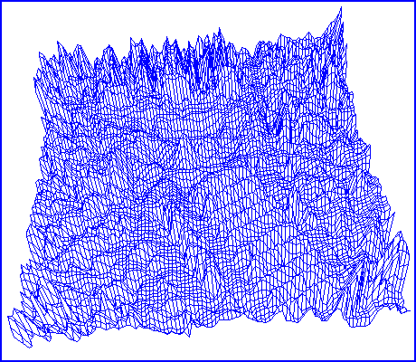
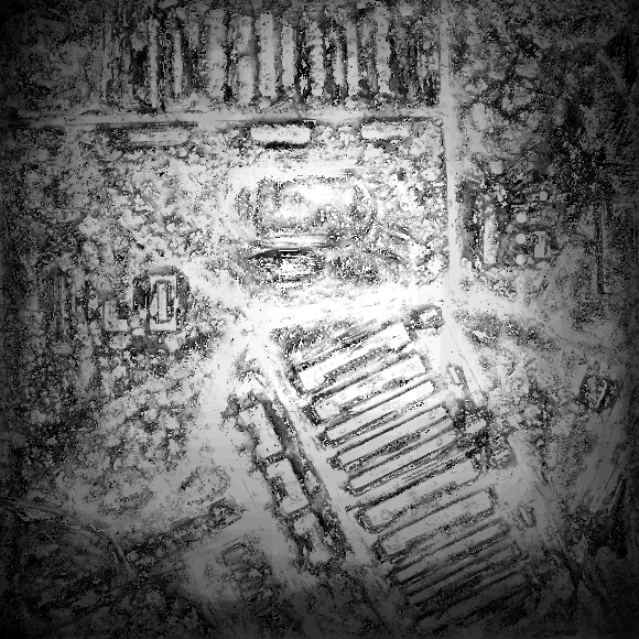
| Multiple-view terrain reconstruction |
|---|
|
| Reconstructed DEM (range image) |
|
| Reconstructed DEM (ortho image) |
|
| Reconstructed DEM (wire model) |
|
| Grey-coded visibility of the DEM to cameras |
| (41 grey level: from black (0) to white (40 cameras)) |